Find out what to do in Valls and surroundings!


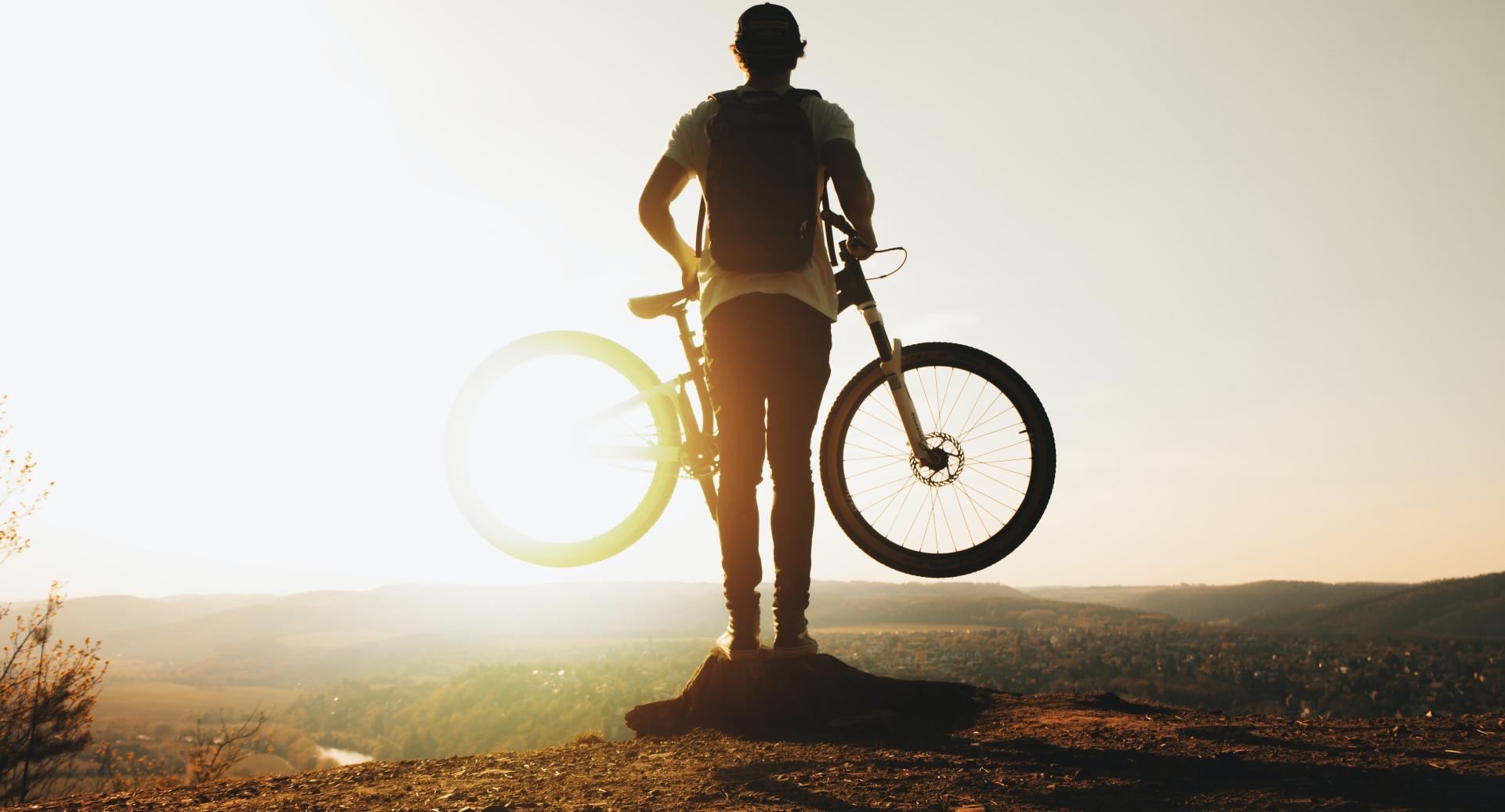
The Hotel Class Valls invites you to discover the most interesting hiking and mountain biking routes in the Valls area and surroundings. Take advantage of your stay at the Hotel to get to know this area of the Costa Dorada at the stroke of a pedal!
Distance: 32 km.
Elevation: 50 m.
Markings: Mostly marked.
Duration: 2 h 30 min.
The route begins in Valls, from which rises in the Passeig de l'Estacio towards Tarragona.
When you reach a roundabout, take a detour to Nulles. After a mile, on a bend of the road, go straight for an asphalt section.
Later (km 2) paved the piece ends. When you reach down to a small terrace, climb to the left to return to the road width. Go down to find a path with white and red signals of GR-7-2 (long distance footpath).
It is a signpost and continues towards Nulles. It crosses the railway by a bridge and keep right.
It leads (km 5.6) to a crossroads and take the detour ambush up ahead. After a stop crossing the road and must go to Vilabella, where you start from the front of the church by the Carrer de Sant Magi.
At 10 miles you come to a fork and you have to turn left. Then you cross the road to the right Bràfim Gaià. Across the river stands the Tossa Grossa. On a trail in poor condition is reached, skirting the reeds, a rutted road to be taken.
Later take a detour to the right (km 11.8) leading to Montferri, where you can visit the ancient castle, now converted into a restaurant.
Leave the village by the road T-204 in the direction of a curve Vilardida and take the first turning on the right. It also appears on the right the chapel of the Virgin of Montserrat. Rodonyà is reached, where it is highly recommended a visit to his castle.
Cross the street people by Angel Guimerà, Sant Roc and Verge de Montserrat and exit via the C-51 towards Valls.
Appears a detour that leads to Can Ferrer (km 16.7). The trail passes over the AP-2. Immediately turn left onto the main road (km 18) to get to Vila-rodona.
From the village you can visit the Roman columbarium and the castle, situated on its highest point.
Continue along the road towards the TV-2004 Pla de Santa Maria.
Two kilometers later, and 24 of course, take a detour on the left signposted: the GR-7-2. The trail will pass through the top of the village of Alió. You continue until the road comes close to the road.
Turn the right fork (km 26.5) and passed by a Republican former airfield.
Beyond are the white and yellow markings of a PR (Short Distance trail). Finally it leads to another junction (km 29.5) and is followed by the left to Valls, where the road enters the station.
End of the tour.
Distance: 14:36 km
Climb: 110.0 m
Duration: 3 h 20 min
Vertical descent: 110.0 m
Flat terrain and good roads and tracks - some paved, in general.
Landscape of crops, forests near the Bridge. Pagès beautiful villages.
If it has rained recently, the mud can complicate the trip. Attention also to the passage of small stream that lies beyond the Mare de Deu of Lloret, as some children do not get stone by stone.
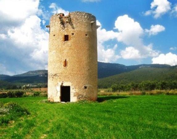
We emphasize the chapel near the town of Montferri, the Monastery of the Holy Cross, the odd Winery, stone ravines in the plains of Pla.
To get to the Pla de Santa Maria you can take the AP -2 and the C -37 to Igualada Valls. Note the church of San Ramón de Penyafort, built at the end of s. Twelfth and early thirteenth centuries, the period of transition from Romanesque to Gothic. It has been included within the Cistercian Romanesque style. I was under the patronage of Santa María.
0 km (398 m). Before this church begins the walk. It leaves the Pla de Santa Maria Cemetery for the ride, which is the road that goes bananas surrounded by the right of the cemetery towards Sarral. You reach a junction and keep left towards Goat Camp - Sarral. A few meters to take a track off to the right signposted route home with white markings, and the bridge of the motorway AP-2 is passed.
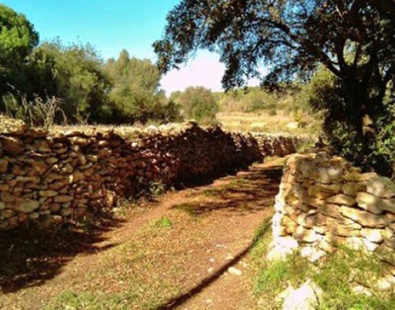
1.5 km (403 m), 0 h 21 min. You cross a ford the stream of Fonollosa and 50 m downstream is turned up. You reach a fork with local brand itinerary: continue on the right path leaving the main track. A few meters into a field where the path is unclear and continue traveling the low stone wall that borders the vineyards northeast. After 100 meters turn 90 degrees to the right following the wall blocks. Is again rotated 90 degrees to the left along the wall and also passing a stone house.
2.5 km (398 m), 0 h 35 min. Moliner ditch. Follow upstream and passes a rockery. Then you need to climb the path followed by the other side. The few remaining traces of way between the ditch and stop seeding followed.
2.75 km (408 m), 0 h 40 min. San Pedro Road, between the terms of the Plan de Santa María and Goat Camp. Continue to the right towards the church of San Pedro de Gaia. You reach a junction: follow the road coming straight, always towards the hermitage. You reach an almond and the road forks: it follows from the right.
3.9 km (404 m), 0 h 56 min. Highway Pont d' Armentera (Valls Igualada) crosses and keep straight on the trail towards the hermitage of San Pedro.
4.2 km (406 m), 1 h 01 min. You reach the main entrance of the estate of Cal Sukkot and more .
6.3 km (395 m), 1 h 34 min. Access is at the intersection of the highways of San Pedro and the Mountaineers . Here the milestone of three terms is: the Pla de Santa Maria, and the Pont d'Aiguamúrcia Armentera (following the path of San Pedro about 800 m you will reach the hermitage of San Pedro de Gaia). You take the way of the Mountaineers right direction Valls. At 400 m there is another fork and continue along the left towards the Mas de la Capona. Ahead lies a fork: it follows from the right toward the house, which is near. Continue along the track, now lean towards the left, until you reach an almond and the junction with the road leading to the house.
The Mas de la Capona is one of the most important country houses that were in the end, as I had the winery and mill own among other agencies, and was inhabited until 1995. Currently threatening debris. Continue along the path to the left. It runs alongside the barracks Augé. You reach a trail marked with several options: take the left always following the white and red GR or Cistercian Route 175.
9.1 km (372 m), 2 h 10 min. To the right of way is a container, dry stone building that was used to collect water from the road and keep the Mountaineers a good season for watering livestock . A central column supports four arches delimiting four laps from the ceiling.
10.7 km (350 m), 2 h 34 min. Ford is passed ditch Zorro.
11.3 km (354 m), 2 h 42 min. The torrent of Fonollosa and a paved trail is located: a ford crossing and continue on the other side going to the right.
13.1 km (378 m), 3 h 08 min. Valls road to Igualada (NO ) crosses through the left of a gas station. The first houses of the Pla de Santa Maria are.
13.5 km (379 m), 3 h 14 min. Cabra Road (NO ) crosses and enters the village by the Santes creus Street, continuing on Anselm Clave, treasury and Town Square.
14.36 km (398 m), 3 h 20 min. We return to the starting point , the church of San Ramón de Penyafort.
Counties: Alt Camp
Distance: 28.78 km
Climb: 360.0 m
Duration: 1 h 42 min
Vertical descent: 360.0 m
If you go with a private vehicle , is reached by the A2 (exit 11) and then the TP-2002 road passing by Vila-rodona and reaches the Santes Creus. The signs leading to the monastery followed. You can park in the parking area existing in the wall surrounding the monastery. In the Plaça de Sant Bernat is the entrance of the monastery and the city .
0.00 km (311 m). The route begins on the Plaça de Sant Bernat. Looking at the facade of the monastery, the left side of the square is a tunnel: is still going under the tunnel (Carrer de la Ferreria), which is a narrow street with a slight slope that exits the monastic enclosure. At the end of the street a small square with 3 mulberry is. Turn right, up until you find the road along the monastery. The road to the right is taken and always follow the wall around the monastery. The wall is around the corner right along a paved road , and continues resiguiéndolo be watching behind the monastery.
1.20 km (300 m). You enter the urbanization Els Manantials by Carrer de la Vinya Closa. It goes down the street at the end of the descent we reach the road and GR signals are reunited. The left hand road towards Aiguamúrcia gets. From there you should go following signs of GR 172-1, provided with red and white paint.
2.40 km (275 m). Aiguamúrcia. Continue onto the next straight street ( Carrer de les Deveses ) following the sign towards Vila-rodona. Follow the red and white markings. It passes in front of a shrine; then the road goes down the stairs on the right. You continue along a narrow street, turn right and it will give the road. Continue along the road for about 250 meters until you signal indicating GR - Vila-rodona by a path down the left hand (2.95 km route). Continue along this road; there is a section in which it will aperarse bicycle, especially when crossing the stream several times by three rustic wooden walkways that are encountered on. We must follow the path marked with red and white markings.
4.60 km (271 m). Vila-rodona. It is reached by the Avinguda de l'Alt Camp. If you continue along the Avinguda Pau Casals, is to give the castle; if it continues through the tunnel and turn right, following the Carrer Sant Llorenç, will reach the Plaça de l'Església. The road is passing the Plaça de l'Església, always straight At the end of Carrer Josep Maria Ferrer is a road that goes left and the Carrer Vilardida, following straight: take the Carrer Vilardida rectum.
5.50 km (254 m). A detour to the right leads to a columbarium, located 300 m away, worth admiring. It becomes the same route.
7.70 km (235 m). It passes under the freeway.
8.70 km (230 m). Vilardida. After 20 m you will reach the road to follow the right.
9.50 km (232 m). Goes a dirt road on the left signposted from the address Bràfim GR 172-1: follow in that direction.
11,30 km (246 m). Crossroads. It follows the left towards Bràfim. Then there is a road to the right direction following Bràfim.
12,00 km (233 m). Bràfim. You enter the village at Avinguda de l'Alt Camp, continues up to the square and go straight for the Avinguda de Catalunya. At the end of the avenue, on the right, take the Carrer Verdaguer, crosses the Carrer Major and Carrer Sant Isidre take the left, then right. It is down and hits the road: go straight, wider road crossing and continue straight.
12,90 km (235 m) . In a right hand curve leaves a path up straight because the route goes left. From there is always followed by the paved up to Alió.
16.50 km (261 m). Allied . Go up the Carrer Vendrell Pare down to the road. The road to fetch the Plaça Nova, which is just a little ahead right crosses. Continue along the left side of the Plaça Nova and turn left along the Carrer Major. It follows the Carrer Major up to the Plaça del Castell, lower right hand side is taken and at the end of it, turn left: the red and white markings are followed.
18,45 km (263 m). You reach a junction of three roads , where there is a sign indicating the Holy Cross - Valls. It takes the path to the right , toward the Santes Creus. At 100 m there is a fork : it follows the right path.
19,00 km (269 m). End white and yellow signs and GR 172 is taken. From that moment we must always follow the Santes Creus signaling and GR 172 brands of red and white paint.
22.50 km (296 m). The motorway tunnel through the crosses.
23.20 km (315 m). You reach the road. Beware! Be crossed and take the path that is right in front the other hand, is a dangerous spot because it is between two curves.
24.00 km (335 m). We must follow the track to the right following towards the Santes Creus (GR 172).
25.40 km (340 m). Continue along the road leaving the track to the right.
26.50 km (355 m). Camping . It follows the path down to the right just after the camping. At that point begins a decline. Pay attention to the last stretch before reaching the road: a sharp curve to the left with a path that leads straight; should bend the curve to the right and go down.
27.70 km (315 m). Road. Continue along the road to the left towards the Santes Creus: already see the monastery. It goes down the road to find a turnoff to the right that says the Santes Creus Monastery. As they passed the bridge turn right and follow this street straight until you get back to the monastery.
28.80 km (312 m). Return to the monastery.
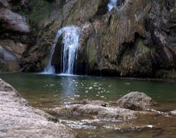
Distance: 13.8 km. Uploaded Elevation: 500.0 m. Gradient Descent: 500.0 m. Signage: Yes. Duration: 3 h. To access the starting point of the route to take, in Alcover, the road leading to Mont-ral (TV-7041) and in a curve before leaving the village, along a track traced straight wide and leave the asphalt road on the right. Some fields will reach the hermitage of Mare de Deu del Remei, where you park your car and start the tour. The temple, built in baroque style and the s. XVIII is located on the side of the mountain which overlooks the valley of Glorieta. It has also a source of drinking water. We take the forest track, flat, he approaches the river. The route is marked with white and yellow markings of the PR-C-20. Cross the roundabout after half an hour and (342 m, 2 km) and climb the right margin. At 3.8 km you cross the river again Glorieta (447 m) and climb the left, passing by a former power station. The road becomes a trail that climbs steeply below. At the raft 4.8km is fueling the central, 250 meters later, a milestone that indicates a path on the left going down to the sources of the roundabout at the bottom of a pool, spectacular when low water above.
